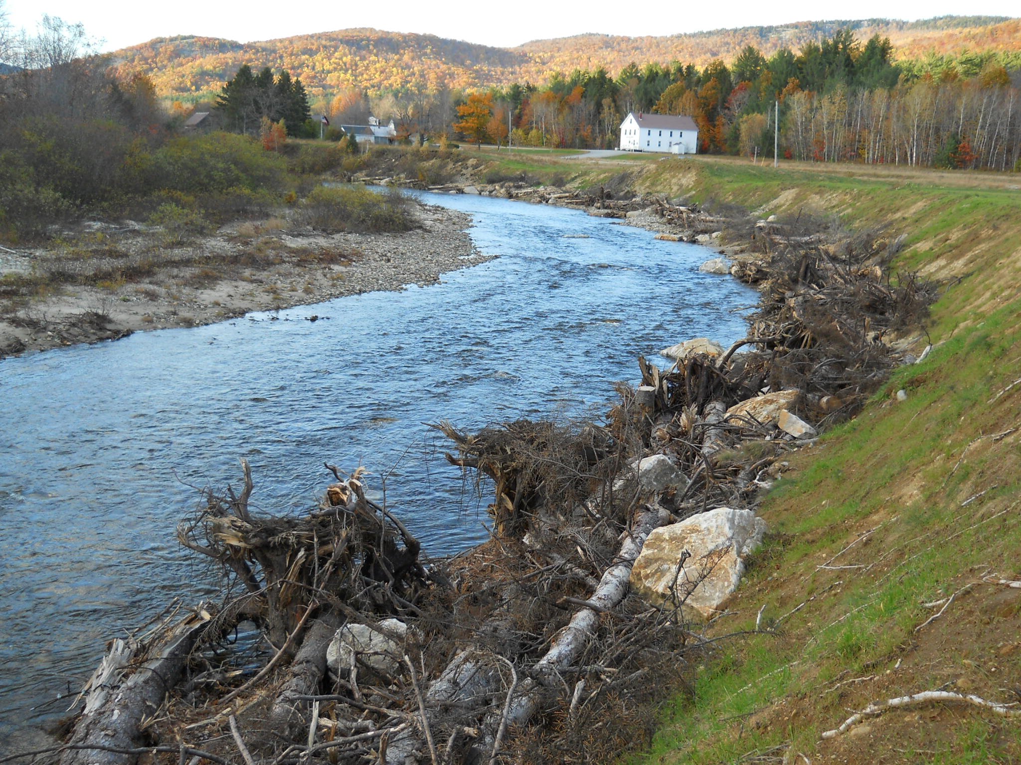
Bear River Bank Stabilization
In August, 2010, ARWC and the Town of Newry partnered to fix a huge erosion problem on the Bear River. This project treated 540 feet of unstable, rapidly-eroding riverbank near the historic Black Cemetery and Bear River Road (Route 26) diagonally across from the Newry Grange Hall.
Eight rock vanes, also known as deflectors, and numerous debris jams were installed according to a plan developed by Field Geology Services LLC and the Town of Newry engineer. Grass and seedling pine trees were planted on the formerly bare bank slope. The vanes, which stick out into the channel facing upstream, kick water into the middle of the channel and away from the vulnerable banks. Debris jams provide additional protection to the toe of the bank and provide good cover for trout. Permits were obtained from the Maine Department of Environmental Protection, U.S. Army Corps of Engineers, and the Town of Newry – floodplain and shoreland zoning. An archaeological survey was conducted by the State of Maine.
This project is expected to restore and enhance brook trout habitat connectivity between the upper and lower reaches of the Bear River by:
Stabilizing the banks and reducing the phenomenal amount of erosion that took place at this site prior to construction (measured at 891 tons/year);
Narrowing and deepening a formerly over-widened, shallow reach of the river. This will cool the water and make it more amenable to trout passage;
The debris jams (which are anchored to rocks) provide cover where none existed previously;
Rock vanes were constructed in a manner that will cause scouring of deep pools favored by adult trout;
The rock vanes and debris jams create diversity in the flow regime whereas pre-construction this area consisted of a shallow run with no diversity.
-
![]()
Before
-
![]()
After